Developing a vehicle loss-of-control risk parameter for forecast models and mesoanalysis
By DAN ROBINSON Editor/Photographer
The purpose of this parameter is to allow quick identification of regions at risk of developing hazardous road conditions due to winter precipitation. The parameter will focus on conditions that pose the highest risk of vehicle loss-of-control incidents.
Factors that increase the risk of hazardous roads
During any type of precipitation, the following factors have an additive effect on the overall risk of hazardous roads:
Surface temperatures at or below 32°F OR surface wet bulb temperatures below 32°F. All precipitation types begin to freeze on road surfaces at surface air temperatures or below the freezing mark. Wet bulb temperatures below freezing will result in a rapid temperature drop during falling precipitation.
Surface temperatures between 25°F and 29°F. Empirical observations have revealed that the highest-impact winter precipitation events occur within a surface air temperature range of 25°F to 29°F. Some of this is simply due to most winter precipitation events occuring on the immediate cold side of a baroclinic system, where air colder than 25°F remains farther to the north and/or west of the primary baroclinic zone. However, it has been observed that intermittent melting and refreezing of fallen precipitation results in the formation of a more slick surface of solid ice. For this to occur, the surface temperature must be both below freezing AND close enough to the freezing mark that automotive traffic can cause temporary melting of the fallen hydrometeors.
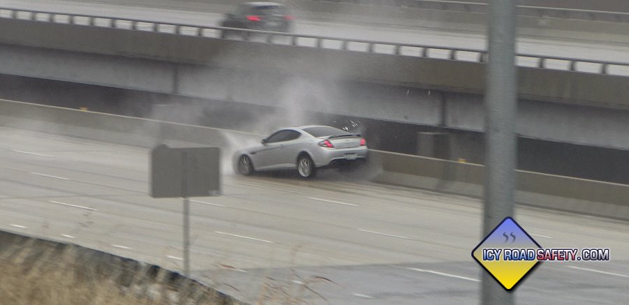
Fig 1. Refreezing of fallen sleet into solid ice due to traffic-induced melting.
6 to 12 hour prior history of temperatures below 32°F. A longer period of subfreezing temperatures prior to the onset of precipitation allows road surfaces to reach the freezing mark.
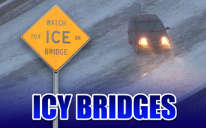
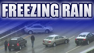
Precipitation type of freezing rain or freezing drizzle. The slickest road surface conditions are created by freezing rain and freezing drizzle, and these precipitation types result in a hazardous road surface lacking in visual cues for motorists.
Precipitation amounts. Any QPF correlating with subfreezing surface temperatures indicates a risk of hazardous road conditions. Higher hourly QFP amounts correlate with a more rapid onset and maintenance of hazardous conditions. Frozen hydrometeors also have a cooling effect on surface temperatures.
A region's de-icing capacity. Southern US states have very little de-icing capability (salt/brine stockpiles, salt/brine trucks, plows and crews) to treat and clear roads during winter precipitation events.
Unanticipated winter precipitation. An unexpected winter precipitation event can cause hazardous road conditions before deicing efforts can be fully deployed. Conditions where this factor would be indicated would be short-term forecasts for winter precipitation OR developing/observed winter precipitation in areas where there have not been winter weather advisories, watches or warnings. Even in regions with adequate de-icing capability, crews and trucks take at least 2 hours to mobilize for an event.
Proposed model/mesoanalysis parameter
Let's turn the above information into a series of if-then statements, that when added cumulatively, result in a LCR value that can be output into gridpoints in forecast models and realtime mesoanalysis displays. We'll designate the parameter LCR (vehicle Loss-of-Control Risk). LCR starts with a default value of 0 and is intended to be a short-term (1-hour) parameter.
LCR activation criteria: LCR remains at 0 until one of the following criteria for a gridpoint is met:
Snow or sleet (any QPF) occuring at temperatures at or below 36°F
Rain or drizzle (any QPF) occuring when temperatures are at or below 32°F, OR if surface temperatures are below 36°F AND surface wet bulb temperatures are below 32°F.
Surface temperatures (T) at or below 32°F AND relative humidity (RH) >=98% (freezing fog potential).
Precipitation amounts (QPF). When:
Surface temperatures are below 36°F AND
Surface wet bulb temperatures are below 32°F
and 1-hour liquid or liquid-equivalent QPF amounts are:
>=trace and <0.1", then LCR + 1.
>=0.1" and <0.25", then LCR + 2.
>=0.25", then LCR + 3.
Surface temperatures (T) at or below 32°F. If T <= 32°F, then LCR + 1.
Surface temperatures (T) between 25°F and 29°F. If T <=29°F AND T >=25°F, then LCR + 2.
6 hour prior history (Th) of temperatures below 32°F. If the 6-hour average temperature T has been <=32°F, then LCR + 1.
Precipitation type (Ptype) of freezing rain or freezing drizzle. If Ptype is freezing rain or freezing drizzle, then LCR + 2.
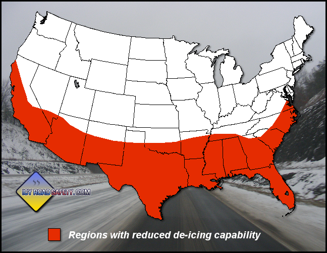
A region's de-icing capabilities (D). A geographical factor (D). In regions with robust de-icing capability, no change to LCR. If occuring in regions with little to no deicing capability, then LCR + 3. The current methodology is to apply this factor for regions south of the 35° latitude.
Fig 2. Approximate geographic area of reduced de-icing capacity in the USA.
Unanticipated winter precipitation (U)*. If winter precipitation is occuring with no prior winter weather advisory/watch/warning issuance within the past 3 hours, then LCR + 2.
If QPF=0 AND surface temperatures (T) are at or below 32°F AND relative humidity (RH) >=98% (freezing fog potential). If QPF=0 AND T <= 32°F AND RH >=98%, then LCR = 3. Freezing fog LCR is a standalone value that should not be invoked if QPF>0. If QPF>0, freezing fog potential does not influence LCR.
Maximum LCR value The maximum value for LCR using the above criteria is 14.
LCR color scale and risk levels
The proposed LCR color scale mimics the SPC convective severe weather and WPC flood risk outlook scales.
Fig 3. LCR color/risk scale.
Example LCR values for selected events
February 11, 2021 - Fort Worth, Texas: LCR = 11
December 16, 2016 - St. Louis, MO: LCR = 10
February 15, 2021 - Houston, Texas: LCR = 10
January 6, 2017 - Birmingham, AL: LCR = 10
January 18, 2015 - New Brunswick, NJ: LCR = 9
November 1, 2021 - North Platte, NE: LCR = 4
Limitations
LCR is a short-term parameter intended to display the realtime and future forecast risk of winter precipitation road impacts. It does not account for lingering impacts from untreated roads after precipitation has fallen. It can be assumed that if surface temperatures remain below freezing and no road treatment has taken place, then the vehicle loss-of-control risk will remain at its previous maximum level until either salt/brine treatment is applied or surface temperatures warm above freezing.
Current development status
November 14, 2021: The following is the current state of the Python script that will be run on each model gridpoint to calculate the LCR value for that location.
Items that need fixed or developed:
.to functions returning an error: the Metpy Celsius to Fahrenheit conversion functions produce the following error: AttributeError: 'DataArray' object has no attribute 'to'
Cannot perform function with conditionals in a vectorized manner: lcr_calc function returns error: ValueError: The truth value of an array with more than one element is ambiguous. Use a.any() or a.all()
To be developed: function to create 6-hour temperature history
Current Python script
import pygrib
import numpy as np
import xarray as xr
import cartopy.crs as ccrs
import metpy.calc as mpcalc
from metpy.units import units
import metpy