DALLAS-FORT WORTH, TX - At about 6am on Thursday, February 11, 2021, a pileup involving 133 vehicles occurred on Interstate 35 West 2 miles north of downtown Fort Worth, Texas. 6 people lost their lives and at least 60 were injured, with 36 requiring transport to a hospital. This article will examine the cause of this tragedy and offer a potential solution to prevent similar incidents in the future. Please note that this is an independently-produced analysis, and it is not affiliated in any way with the NTSB or any government agency.
The Fort Worth pileup, in all reality, requires no in-depth investigation. Simply put, this event was a result of freezing rain bridge icing. There are some factors that contributed to the severity of this incident, which I'll be covering in this article - but the primary cause of the pileup is this well-known, easily-forecasted phenomenon that routinely causes thousands of serious and fatal crashes every winter.
Before we get into the DFW event, let's go over the two main considerations for a winter weather event occurring in a region like the Dallas-Fort Worth metroplex that does not regularly experience winter precipitation:
The driving public has little to no experience with winter driving and winter weather advisories/watches and warnings.
These regions usually do not invest much funds in deicing capability. There is a limited number of salt/brine trucks and plows in these areas, and there is limited personnel to operate the amount of equipment required to adequately treat roads and bridges. Some regions only employ sand on iced surfaces, which does not melt the ice but rather is intended to provide a limited amount of traction.
This map provides a good approximation of where you would expect to see fewer deicing operations. My personal observations from covering many southern US winter storms (east of the Rocky Mountains) is that deicing capability drops off sharply south of approximately the Interstate 40 latitude (Amarillo, TX; Oklahoma City, OK; Little Rock, AR; Memphis/Nashville TN).
Fig 1a: Winter weather frequency, by US county Source: FEMA
The common winter weather strategy for these southern regions is to simply shut everything down, stay home and wait for the inevitable warm temperatures to melt the ice after a day or two. Even fast food restaurants, grocery stores and gas stations close down during winter storms in the South. Many local authorities will completely close their larger highway bridges and interchanges to all traffic while they are iced, rather than make any effort to treat or clear them.
Fig 1b: Closed icy highway interchange in Baton Rouge, LA
Fig 1c: Deserted highways during Houston, TX winter storm
Fig 1d: Fast food restaurants closed during winter storm in Mississippi
The Dallas-Fort Worth metroplex is firmly within this zone of the United States that rarely sees winter precipitation, and accordingly, does not have robust deicing capacity like cities and states farther north. While the DFW region does employ a small fleet of brine trucks, they are insufficient to adequately cover the entire metro area during a major event (and should not be expected to).
The bottom line is, all drivers simply must expect bridges and roads to be very hazardous when driving during southern US winter precipitation, unlike in the northern 2/3 of the United States where regular plowing and salting keeps roads passible (if not mostly clear) during identical events.
Meteorological setting on February 10-11, 2021
A strong artic cold front pushed southward through north Texas and the Dallas-Fort Worth metroplex on Monday, February 8. By the Wednesday the 10th, this cold front was situated along the Gulf Coast, with continued cold advection steadily causing surface temperatures across the state to fall.
Fig 2a: WPC surface analysis at 00z (6PM CST) on February 10, 2021
The upper air pattern was characterized by broad southwesterly flow with multiple shortwave disturbances bringing several waves of precipitation to the area.
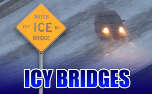
Bridge Icing: The Basics
Bridge icing happens during most winter precipitation events, and freezing rain bridge icing poses the greatest threat to the driving public than any other precipitation type.
Let's briefly cover why bridges ice first before roads on solid ground. If you're interested in this topic in more detail, I have a page and video dedicated to the subject. Bridges are exposed to the surrounding air on all sides. Surface roads, by contrast, are only exposed to the air from above, with the warmer ground providing further insulation from rapid temperature changes. Bridge surface temperatures will quickly match falling air temperatures. Once air temperatures fall below freezing, bridge temperatures lag by only a few minutes, resulting in any frozen precipitation instantly and efficiently accumulating on a bridge.
Fig 3a: Animated illustration of falling bridge and air temperatures
As these photos show, snow illustrates the concept quite dramatically. The road goes from clear to slick in a few inches. What makes bridge icing dangerous is that it creates small, isolated areas of slick road conditions among long stretches of road that are dry or just wet. Drivers who aren't aware of the hazard will often be traveling at normal speeds before they encounter a bridge. It is this element of surprise that leads to serious crashes that occur at much higher speeds than when all roads are covered in ice or snow.
Fig 3b: Icy bridge in Bloomsdale, Missouri
Fig 3c: Icy bridge in Kanawha County, West Virginia
Fig 3d: Icy bridge in Beckley, West Virginia
Fig 3e: Icy bridge road surface condition transition zone
Fig 3f: Icy bridges in Birmingham, Alabama
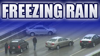
Now let's add in the factor of freezing rain. Freezing rain and its close relative freezing drizzle - not only create the slickest road conditions of any winter precipitation type, but the icing is nearly impossible to see. These photos show several examples of bridges iced from freezing rain. Can you see the ice?
Fig 3g: Freezing rain icing on bridge near Winnie, Texas
This nighttime image of a freezing rain-iced bridge represents how bridge icing looked on the night of February 10 and morning of February 11, 2021 in the Dallas-Fort Worth metroplex:
Fig 3h: Freezing rain icing on bridge near Beckley, West Virginia
Most drivers won't be able to recognize freezing rain icing until they're out of control, or when they press their brakes and nothing happens. If you want to learn more about freezing rain, I published an in-depth video on the phenomenon also available on my Youtube channel. Simply put, freezing rain is the worst of the worst when it comes to winter precipitation. Not only is it treacherous, it's invisible.
When bridge icing occurs during freezing rain, the results are often catastrophic. Often, the first sign of freezing rain bridge icing to the unaware driver is when their vehicle suddenly begins sliding out of control. I've talked to drivers who, after losing control, thought something was wrong with their car's steering: they never saw the ice!
Bridge icing in the DFW metroplex on February 10-11, 2021
Now that we've covered the basics of freezing rain bridge icing, let's take a look at how those conditions played out in the Dallas-Fort Worth metroplex on the evening of February 10 into the morning of the 11th.
I assembled this 15-hour weather conditions animation covering this event from the National Weather Service's Fort Worth radar site, with observed surface temperatures superimposed. The I-35W pileup location is marked with a red dot icon. Locations where I captured bridge icing incidents on camera during the event are marked with yellow dot icons. (You can play the video here on this page, or view it on Youtube).
Fig 4a: KFTW radar loop with superimposed surface temperature observations
The observation site nearest the pileup went offline for several hours, which is why it is displaying M, but it's very clear from the surrounding observations that the temperatures were in the upper 20s - well below freezing - several hours before the pileup occurred. All of the precipitation echoes in this image are areas of freezing rain. Notice how rather than a broad, uniform shield of rain, the precipitation is occuring as a series of small showers. Pay attention to the showers that move over Fort Worth between midnight and 6am.
Another visualization of the freezing rain precipitation swaths can be produced by stacking monochrome versions of the radar images together using Photoshop. This image shows these swaths during the 7-hour period from 11PM and 6AM. Darker blues indicate heavier precipitation amounts:
Fig 4b: Radar-derived precipitation swaths between 0500Z and 1200Z Thursday, February 11, 2021
The Fort Worth NWS published this map of icing totals from the event, noting that precipitation amounts were less than 2 hundredths of an inch across the metroplex:
Fig 4c: NWS ice accumulation totals
I traveled from St. Louis to Dallas-Fort Worth for the purpose of documenting this freezing rain event, as part of a longer 10-day trip to cover the historic arctic surge over the deep South. During this time, I witnessed and captured vehicles losing control on icy bridges in three locations in the Dallas metro area (marked on the radar loop above). I started out in the Rockwall area along Interstate 30 on Wednesday evening or February 10th. You can see the first batch of freezing rain showers moving through Rockwall and Royse City around 9PM. After midnight, I moved up to Lewisville (northern metroplex) when a brief shower of freezing rain passed over the area. You can see this freezing rain shower on the radar image. The result was a rash of vehicles losing control on several I-35 east bridges *within minutes* of the start of the shower. Lastly, I shot icy bridge footage just south of downtown on I-35E. My footage from these three locations can be viewed in the main presentation video linked at the start of this article.
To summarize, bridge icing began causing accidents across the metroplex before 9PM on February 10, mainly in a few corridors where the freezing rain showers had moved through. As the showers continued overnight, more areas throughout the DFW metroplex were impacted by bridge icing and accidents.
Throughout the DFW metroplex, I observed that most drivers were traveling at full highway speeds (65-75mph and higher) during this event. Only in areas where accidents had already occurred did I encounter slower traffic. Everywhere else, traffic was moving at full speeds with the driving public seemingly unaware of the hazard that was in progress. This speed was clearly a factor in all of the loss-of-control incidents I documented on video this night. Video of the pileup shot by bystanders in Fort Worth showed traffic moving at similar speeds consistent with what I observed.
The I-35W Fort Worth bridge pileup
Now let's focus on the I-35W bridge where the pileup occurred. The bridge is located between Northside Drive and 28th street, 2 miles north of downtown Fort Worth. This stretch of I-35W is only a few years old, being completely rebuilt during the North Tarrant Express project which was completed in 2018 (1).
Fig 5a: Fort Worth, TX pileup location (OpenStreetMap)
I constructed a 3D model of the bridge using USGS terrain data as a base. The bridge, which does not have an official name, is 550 feet long and carries a total of 10 lanes for most of its length, widening to 12 lanes shortly before the southern abutment. The bridge begins on a bluff above the West Fork of the Trinity River, and descends downgrade into the river valley, crossing above Watauga Road and the Union Pacific railroad tracks. It carries the mainline lanes of I-35W (shown here in blue) as well as two Express lanes in each direction (shown in green).
Fig 5b, 5c: Fort Worth, TX pileup location configuration, mainline lanes (blue) and express lanes (green)
The express lanes are in the center of the bridge, bounded by concrete barriers. The pileup occurred in the southbound express lanes, highlighted here in red, and mainly at and just beyond the southern end of the bridge.
Fig 5d: I-35W southbound express lanes where the pileup occurred
Obviously, this bridge will ice during freezing rain the same way that any bridge will. Other bridges in the metroplex were icing rapidly during any freezing rain shower that moved overhead, and this one would have been no different. Bystander videos of the Fort Worth pileup showed vehicles in the northbound mainline lanes spinning their wheels (3) and disabled wrecked vehicles in the southbound mainline lanes (4), evidence that indicates the entire bridge was iced, not just the express lanes. I can't comment on details of the deicing operations in the metroplex other to say that I did see brine trucks applying the liquid solution to areas that had already began icing in Rockwall. Based on my experience observing winter weather events, deicing chemicals are often quickly washed away during freezing rain and require repeated applications to remain effective.
I'm not going to make an attempt to recreate the individual collisions in the pileup here, as it's not necessary for this discussion - but I will illustrate some key points of what likely occurred based on the aftermath images. Bridge icing loss of control incidents often result in the vehicle coming to rest some distance beyond the end of the bridge. This is mostly because a vehicle's tires will gain traction suddenly when leaving the ice, sending them rapidly off the road or into a barrier, again, at some distance beyond the end of the bridge. This accounts for why there are several damaged vehicles beyond the end of the bridge. The first few vehicles involved in the pileup would have come to rest in this area, creating an impassable and rigid "plug" in bewteeen the concrete barriers that future approaching vehicles on the iced bridge could not avoid.
Let's take a look at what a driver would have seen approaching the pileup in the southbound express lanes. Just prior to the bridge, the highway gains elevation before cresting at the bridge's northern end, which would result in the southern end of the bridge being invisible to approaching southbound drivers.
Fig 5e: 3D rendering of I-35W southbound express lanes driver view just before bridge
The disabled vehicles already involved in the pileup would not appear to the southbound driver until they were squarely on the downhill section of the treacherously-iced bridge:
Fig 5f: 3D rendering of I-35W southbound express lanes driver view, first view of pileup vehicles
At that point, braking would have little effect, especially at the speeds vehicles were traveling. Again, freezing rain icing is often impossible to visually identify, so most drivers involved in the pileup likely were not aware they were on ice until they attempted to brake on the bridge.
Aftermath images show that the pileup occurred in three distinct clusters on the bridge, with the most vehicles concentrated in the southernmost and northernmost clusters:
Fig 5g: I-35W Fort Worth pileup overview, 3D rendering. View looking northeast. Vehicle types and positions are only approximations.
Speed limits: The speed limit on the express lanes of I-35W at this location is 75mph. The speed limit for the mainline lanes is 65mph.
Barrier confinement: While it is true that the express lanes of I-35W are bounded by concrete barriers that make evasive action by approaching drivers difficult (or impossible), this is not a unique configuration. Travel lanes on all highway bridges are bounded by such barriers, so their presence in this case is not remarkable. As such, they should not be cited as a contributing factor to this incident. Barriers are simply an inherent characteristic of bridges, and cannot be eliminated or reduced.
Fig 5h: Confining barriers are an inherent characteristic of every highway bridge.
Warning signage: Yellow diamond warning signs containing the "Bridge may ice in cold weather" message are in place for the northbound and southbound mainline lanes prior to the bridge as well as the on-ramps to the mainline lanes. No such signs are present on either the northbound or southbound express lanes prior to the bridge.
Preceding bridges: Southbound express lane vehicles would have crossed over a bridge of similar length approximately one and 1/4 miles before encountering the pileup bridge. This bridge over the Fort Worth and Western railroad yard gently curves to the left, a configuration that can induce "oversteer" loss of control on ice when drivers must steer on the curve. The condition of this bridge at the time of the pileup is unknown. The radar loop (shown above) indicates that multiple freezing rain showers did pass over this bridge's location prior to the pileup.
Fig 5i: Locations of pileup bridge and preceding bridge on I-35W (OpenStreetMap)
National Weather Service advisory
This event was well-forecasted and warned by the National Weather Service. The Fort Worth NWS office issued a Winter Weather Advisory for the metroplex on Wednesday afternoon the 10th, valid through Thursday afternoon the 11th. The advisory covered the impending freezing rain event, and specifically mentioned the risk of bridge icing.
Afternoon Update: The Winter Weather Advisory has been extended until 3 PM Thursday afternoon, and has also expanded to include additional parts of North & Central TX. Hazardous weather conditions could impact the morning commute, so make sure you plan ahead. #dfwwx#ctxwx#txwxpic.twitter.com/5JRyOLnQ3D
Fig 6a: National Weather Service Fort Worth advisory Tweet
Summary of the pileup's cause and contributing factors
So, to recap, the primary cause of the February 11, 2021 Fort Worth pileup was bridge icing from freezing rain. Contributing to the severity of the event was:
Freezing rain icing occurring in showers with narrow swaths
Occurring in a region not accustomed to winter precipitation:
An unaware driving public traveling at full highway speeds
Limited deicing infrastructure
Limited effectiveness of liquid brine on continued freezing rain
Bridge configuration:
Long downhill slope
Hill crest limiting visibility of disabled vehicles
Future Prevention
Bridge icing is very predictable. It's not a mystery or enigmatic. It's one of the simplest types of weather events to forecast. When:
temperatures fall below 32 degrees F (O°C)
there is any type of precipitation falling
de-icing infrastructure is either not available, in short supply or inadequately deployed
... bridges *will* become hazardously iced.
I have spent much of my career focusing on icy roads and their impacts. It was very clear days in advance that the Dallas-Fort Worth metroplex would see a dangerous bridge icing event. I was able to drive 630 miles from St. Louis to be there when it happened. I even posted this tweet 16 hours before the pileup.
Very dangerous freezing drizzle/rain bridge icing event is under way in Texas incl Dallas metro. Threat could last for several days & even extend as far south as Corpus Christi, Brownsville & Houston. Icing from freezing rain is nearly impossible to detect visually. #txwx#dfwwxpic.twitter.com/iO8l50b4ox
— Dan Robinson - icyroadsafety.com (@icyroadsafety) February 10, 2021
Fig 8a: Icyroadsafety Tweet about impending DFW freezing rain event
If an event like this is easy for someone like me, who has no meteorology degree, to see coming ahead of time, then it should be equally easy to prevent.
The National Transportation Safety Board (NTSB) is currently investigating this incident (investigation number HWY21FH005), and the only additional details I expect them to uncover would be regarding the deicing operations in the region on the morning of February 11th. I would expect recommendations ranging from acquisition of addional deicing/salting equipment to completely closing larger highway bridges and/or high-speed travel lanes during winter precipitation events. However, such recommendations will not put a stop to the thousands of other serious crashes caused by freezing rain across the USA.
Road/bridge ice warnings will help the public recognize developing hazardous conditions.
After everything I've researched and witnessed personally, it's been clear that freezing rain - especially when it occurs in areas like Dallas-Fort Worth that are not used to seeing it - warrants a more serious type of warning dissemination to the general public, on the same level as tornado warnings or other public safety alerts. Freezing rain and freezing drizzle routinely result in death and injury counts greater than most tornado and severe storm events. While the Fort Worth pileup was one of the more extreme examples of this, it is far from atypical. Freezing rain and freezing drizzle routinely cause thousands of very serious vehicle accidents every winter season in the United States. But despite this fact, the level of risk from this phenomenon historically has not been communicated well to the public. The Fort Worth office of the National Weather Service did an excellent job of issuing the Winter Weather Advisory for the Dallas-Fort Worth metroplex in plenty of time, but driver behavior clearly was unaffected. So what can be done for future events of this type?
A Winter Weather Advisory simply does not communicate a significant threat to life and property. One possible solution is to treat a Winter Weather Advisory for freezing rain or freezing drizzle like a Tornado Watch. The Advisory means that the conditions are possible or expected. Then, when the icing conditions are confirmed to be in progress within the advisory area, the public should receive a warning alert using the same channels used for tornado warnings: EAS tones should be activated. Cell phones should sound an alarm. Alerts should display on TV and radio broadcasts.
Fig 8b: Example of how an ice warning message would appear on a smartphone
If that had been utilized in DFW on the evening of the 10th and morning of the 11th, the chance to prompt a reduction in driver speeds would have likely had an impact in reducing the severity of (or preventing altogether) many of the incidents seen across the metroplex that night.
Such an "ice warning" is primarily needed in areas like the Southern united states, where winter precipitation is less common and where deicing capability is more limited. However, it could be deployed in any region receiving a "surprise" road icing event that happens before deicing crews can be mobilized. Examples of this include the December 16, 2016 freezing drizzle event in Missouri and the 2015 "Icezilla" event in New England. This is because Department of Highways crews often need at least two hours' notice to mobilize salt trucks and plows (4), meaning that a subtle event that slips by forecasters could cause serious road impacts even in areas where ice and snow are common.
Deicing capacity in the southern third of the United States is not robust enough to keep every bridge properly treated during winter precipitation events. Salting and brining operations are unlikely to ever completely mitigate road and bridge icing in these areas, so they should not be expected to. Dangerous icing should be anticipated by everyone - both the public and officials - to occur on all bridges. The bottom line is: the public needs to be made aware of the level of risk posed by bridge icing, and serious warnings conveyed to everyone when these conditions are in progress.
If you're in the National Weather Service, a state or local Highway Department or Emergency Management, I'd like to hear from you. An "ice warning" protocol is possible - how can we move toward implementing it? Contact me here.
In response to an email, the Pennsylvania Department of Transportation (PennDOT) provided details on their salting and plowing mobilization process and how long it takes to get trucks on the road on short notice.
ABOUT THIS SITE: My name is Dan Robinson, I am a photographer based in the St. Louis area. Since 2003, I have covered all types of extreme weather as a freelance cameraman including hurricanes, tornadoes, floods and winter storms. During my first few years covering winter weather events, I was alarmed by what I was witnessing on the roads during even light winter precipitation events. I decided to begin researching this hazard in detail, and was surprised to discover that vehicle accidents on icy roads are responsible for more than 3 times the amount of deaths and injuries than all other types of weather combined. In 2008, I started the icyroadsafety.com web site as an awareness effort to help drivers recognize how serious these conditions can be and be prepared when they are encountered. I also believe there are measures that can be taken in both the weather and public safety enterprises to help the driving public better manage these hazards.