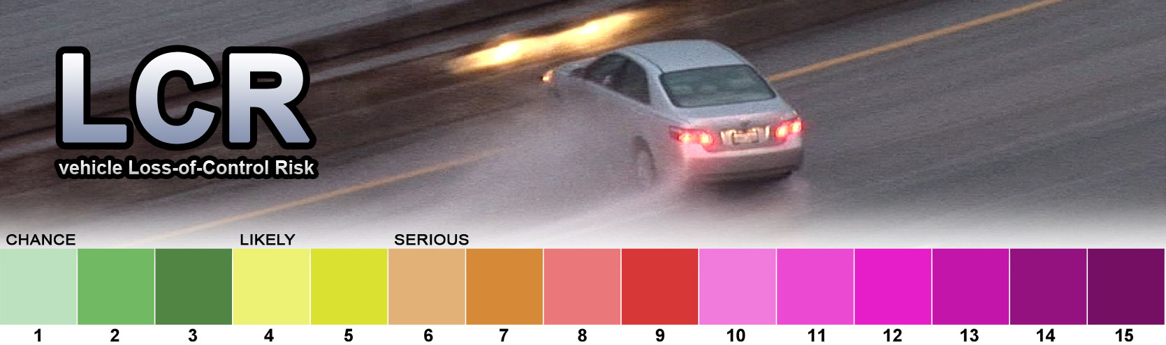
LCR (Loss-of-Control Risk): The risk of a motor vehicle losing control due to reduced road surface friction from winter precipitation. Based on 1-hour precipitation amounts (QPF), precipitation type, surface temperature, surface dewpoint, surface relative humidity and surface wind gusts. LCR charts show the maximum values of LCR expected during the time period represented on the chart. See the
main LCR page for detailed synopsis of LCR calculation.
BFP+: BFP Plus charts show the following four data sets together:
- CIP (Precipitation at/below Critical Icing Temperature): The amount of precipitation (QPF) of any type occurring where surface temperatures are at or below 29.9°F.
- BFP (Below-Freezing Precipitation): The amount of precipitation (QPF) of any type occurring where surface temperatures are at or below freezing (32.9°F).
- NFP (Near-Freezing Precipitation): The amount of precipitation (QPF) of any type occurring where surface temperatures are between 32 and 38 degrees Fahrenheit.
- AFP (Above-Freezing Precipitation): The amount of precipitation (QPF) of any type occurring where surface temperatures are above 38 degrees Fahrenheit.
The scale used on BFP, NFP and AFP is
zero to 0.1 inches of liquid-equivalent precipitation of
any type (rain, snow, sleet, graupel, freezing rain, freezing drizzle, drizzle). Precipitation amounts above 0.1 inches are represented at the same color as 0.1 inches.

